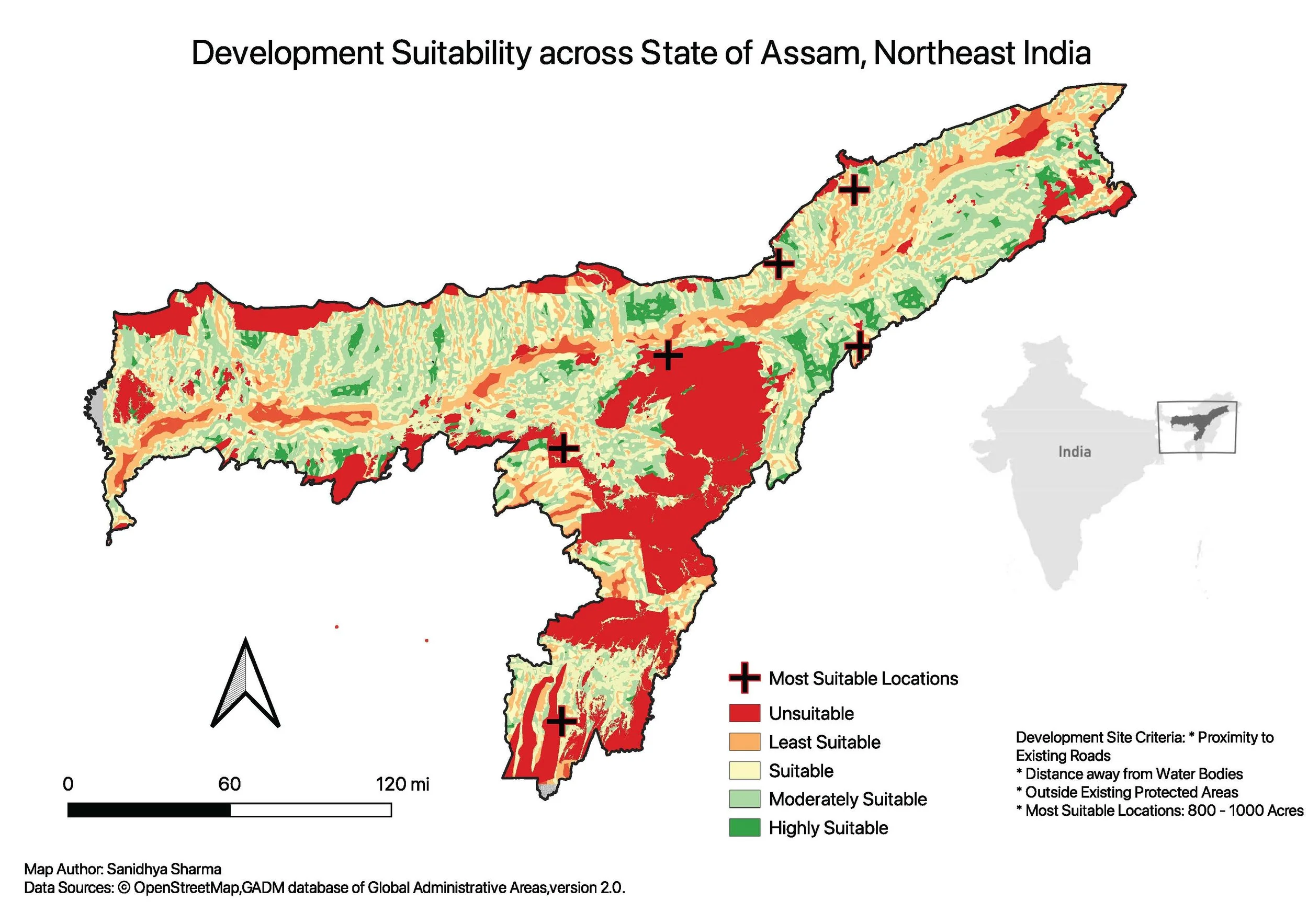
For this assignment, I built a raster-based suitability model to identify optimal development zones in Assam, India. I rasterized road, water, protected area, and boundary layers, then generated proximity surfaces to favor areas near roads and far from water. These were reclassified into weighted suitability scores and combined to produce a final suitability raster. From this, I extracted high-scoring areas between 800–1000 acres and identified eight final development sites based on those criteria.