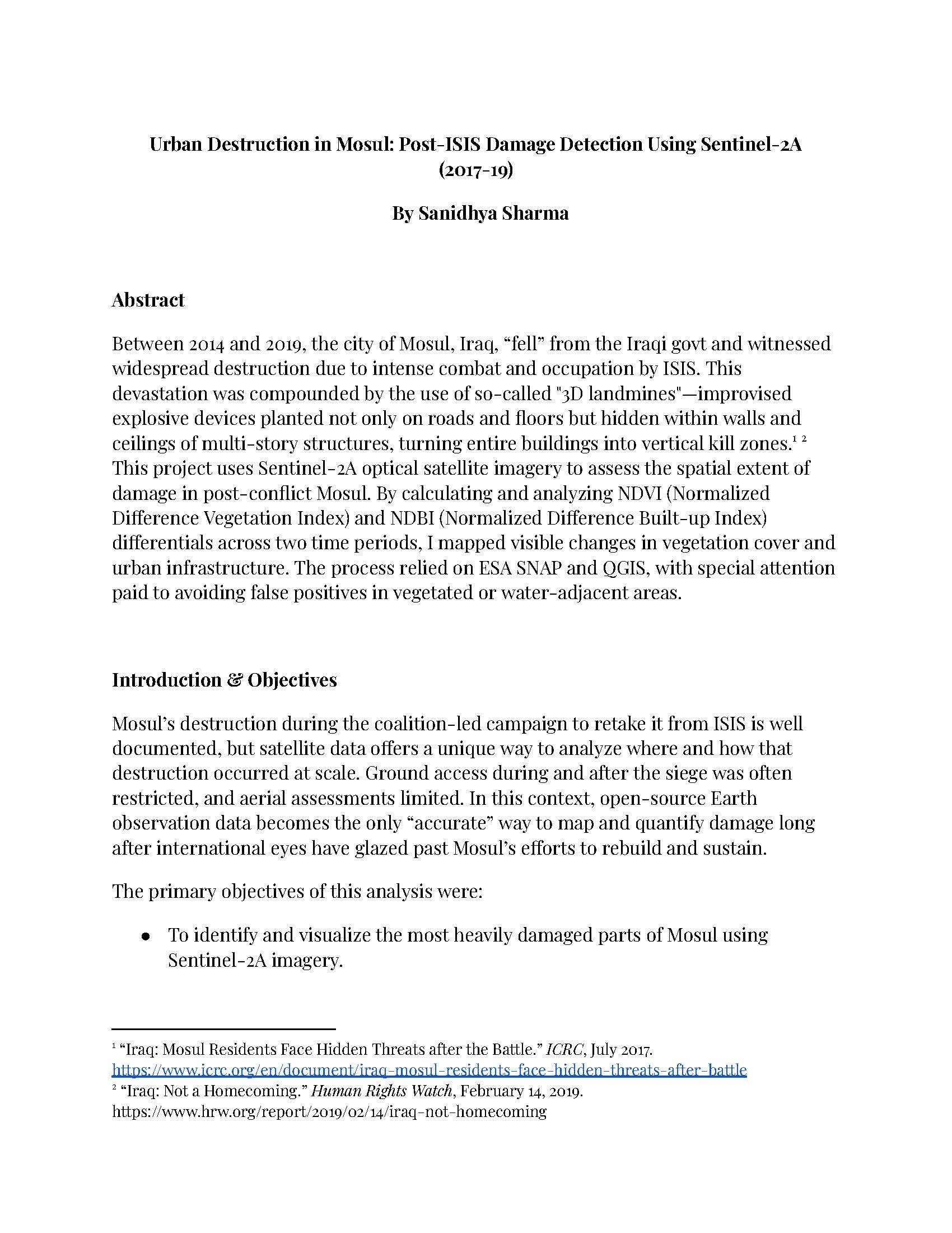
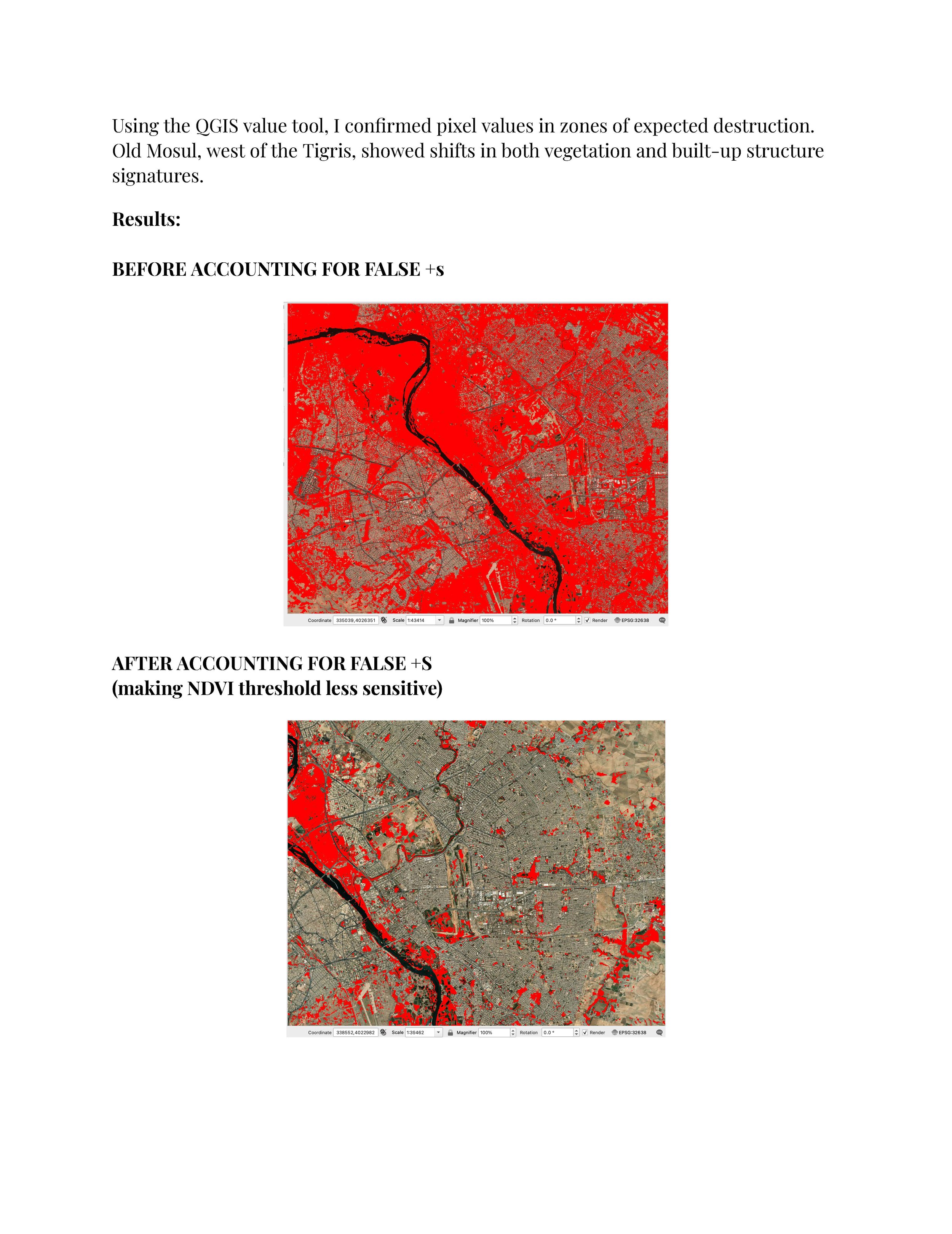
This project analyzes the widespread urban destruction in Mosul following its occupation and liberation during the ISIS conflict. Using satellite imagery, it maps patterns of damage across the city, focusing on collapsed buildings and scorched land. The analysis reveals destruction not just on the surface, but deep within the multi-storied urban fabric—consistent with reports of vertical IEDs and aerial strikes. By comparing vegetation and infrastructure changes over time, the study identifies zones of high-impact violence, especially in the dense Old City. It offers a scalable method to visualize conflict aftermath where on-the-ground access is limited or impossible.